An autonomous sensing node for the maritime edge.
A self-powered, satellite-connected platform that sits on the water and watches it — measuring, detecting, and launching surface and sub-surface drones. It extends the Overwatch grid past the shoreline, into the approaches and anchorages that protect a port.
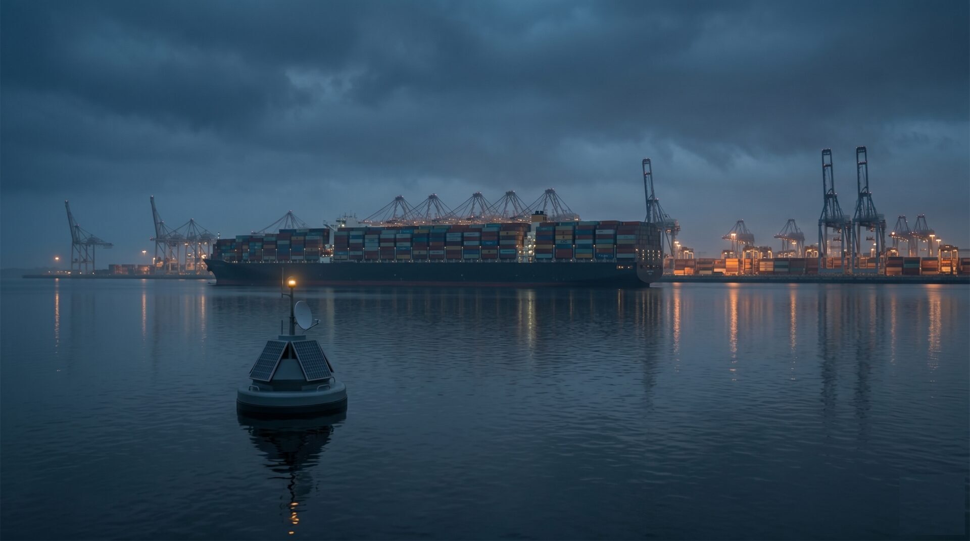
Container-terminal scale, watched from the waterline — autonomous, solar-powered, always on.
A field node that floats.
Ports and maritime authorities have the same blind spot as pipeline and grid operators — only it sits offshore. The approaches, anchorages, and channels that feed a container terminal are watched by radar sweeps and patrol boats, with long gaps in between. The smart buoy closes that gap with a permanent, autonomous presence on the water.
It is an Overwatch field node in a marine hull: solar-powered, satellite-connected, running edge AI on-device. It holds station, senses above and below the surface, and serves as a mobile dock for the surface and sub-surface drones that do the close-in work — all reporting into the same operator console as the rest of the grid.
One hull. Six capabilities.
The smart buoy is a platform, not a single-purpose sensor — engineered to operate unattended for months at a time.
Placement & station-keeping
Deployed where it's needed and able to hold position — or relocate — so coverage follows the operational picture, not a fixed mooring map.
Surface-drone capability
Acts as a launch and charging dock for autonomous surface vehicles, extending reach for inspection, escort, and response across the approaches.
Sub-surface-drone capability
Deploys and recovers underwater drones for hull, seabed, and infrastructure inspection — eyes below the waterline, on demand.
Multi-modal monitoring
Vessel detection and classification, AIS correlation, acoustic and sonar sensing, water quality, weather, and intrusion — fused on-device into events, not raw feeds.
Solar-powered
Solar-first power with storage for months of unattended operation — no support vessel on a fuel run.
Satellite-connected
Satellite uplink with multi-link failover keeps the node live far beyond cellular range, anywhere on the water.
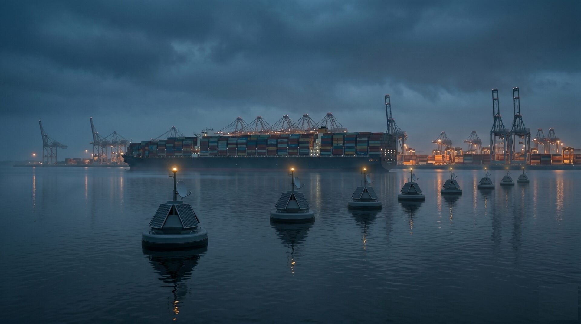
Nodes become a grid — a seaward perimeter that doesn't stop at the quay.
An addition to the grid for maritime ports.
A single buoy is a node. Several form a grid — a continuous sensing perimeter across a harbor's approaches, anchorages, and channels, feeding the same live map your land-side Overwatch deployment already uses. For a port, that means one operational picture that doesn't stop at the quay.
Approach & perimeter awareness
Continuous detection of vessels, small craft, and anomalies across the harbor approaches — the seaward perimeter that radar and patrols cover only intermittently.
Anchorage & channel monitoring
Watch anchorages and channels for drift, incursion, and dark vessels, correlating AIS with what the sensors actually see.
Sub-surface & infrastructure security
Sonar and underwater drones extend awareness below the surface — hulls, seabed, and submerged infrastructure around critical berths.
Environmental & safety
Water quality, spill detection, and weather data on the same nodes — operational awareness and environmental compliance from one grid.
Engineered for the unattended edge.
Indicative platform characteristics — configured to the deployment.
Extend the grid past the shoreline.
If you operate a port, terminal, or maritime approach and your situational awareness stops at the water's edge, the smart buoy is how it keeps going. Let's scope a deployment.