
One node. Many jobs.
Sensors, AI and radios in one solar-powered unit, built for wildfire country, contested borders and remote corridors.
Three layers. Each one keeps working on its own.
The node makes its own calls. The mesh reroutes itself when a link drops. The cloud ties events together and runs the tools your crews use.
NetSAW field nodes
LiDAR, thermal and optical cameras, gas, acoustic and environmental sensors, with AI running on the node. Nodes form a self-healing mesh and fail over between LTE, 5G, WiFi HaLow and satellite.
Private cloud
Zero-trust and multi-tenant, with live event streaming and geospatial queries. Connects to SAP, Oracle and GIS.
Operator portal & field apps
Live map, alerts, role-based access and task dispatch. The mobile and AR / VR apps keep working offline where signal is weak.
Three independent layers of trust.
The same design runs on pipelines, defense perimeters and HIPAA-regulated hospitals. We don't rebuild it for each customer.
Identity
Every device carries its own cryptographic identity. No shared keys, no trust by IP address. Revoke one device without touching the rest.
Communication
Mutually authenticated, end-to-end encrypted channels. No open ports. Everything is denied unless explicitly allowed.
Authorization
No device gets a credential until an admin approves it. Quarantine takes one click.
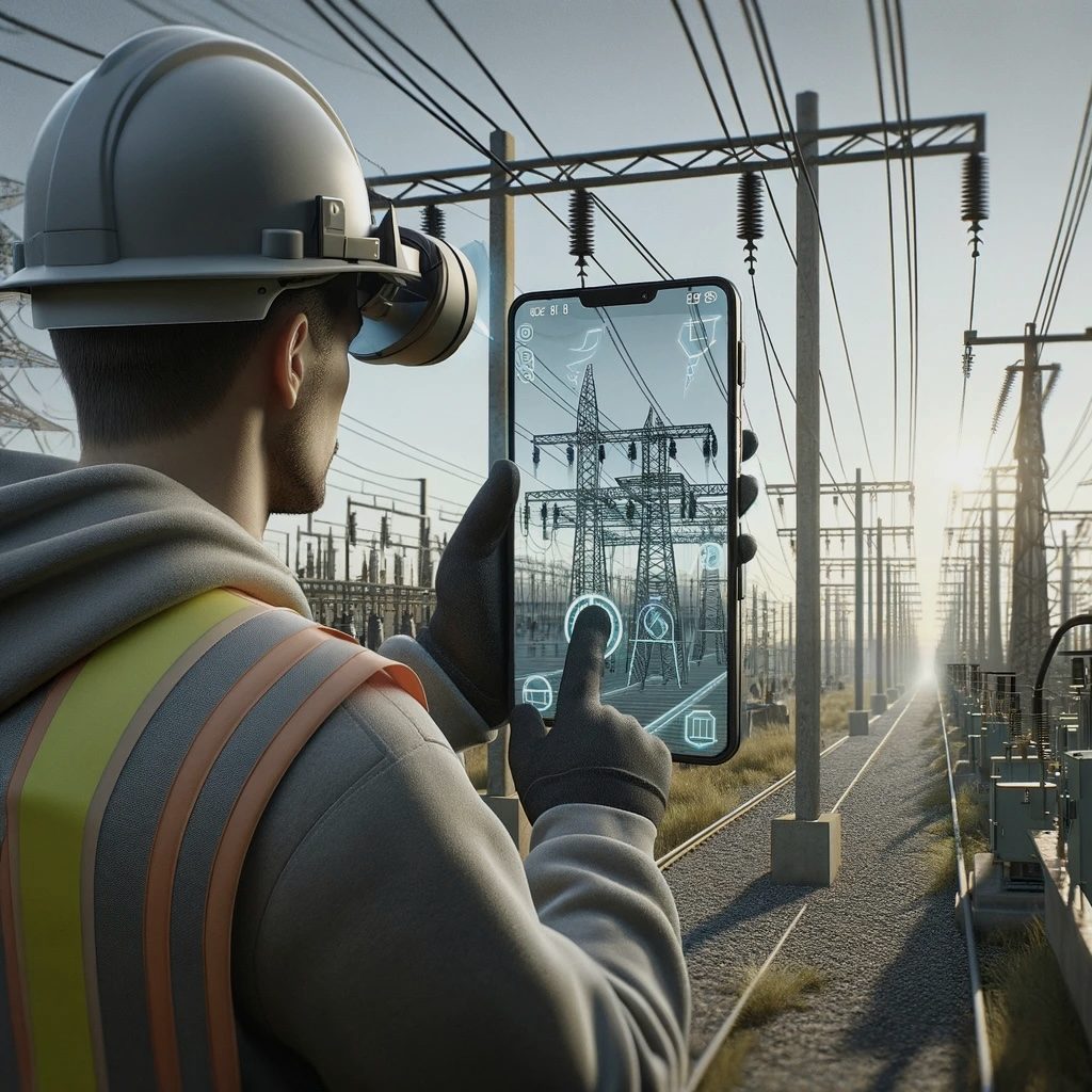
Operators see what the sensors see, laid over the real world.
The node decides. The cloud checks.
Cloud AI needs low latency, bandwidth and a steady link. A remote corridor or a forward base has none of those. So the node decides in milliseconds and the cloud adds context afterward.
Each node carries its own AI accelerator and sends the cloud a summary, not a video stream. Cloud vision and language models then confirm the high-confidence detections.
Multi-modal classification
Fire, smoke, gas, vehicles, intrusion, vegetation and wildlife. Sensors cross-check each other on the node to cut false alarms.
Ranked by context
Each reading is weighed against weather, GIS, asset condition and history. Operators only see alerts that need a response.
Versioned, audited rollouts
Push a new model to a pilot group, then to the fleet. No truck roll.
For verification, not detection
The cloud reviews a short clip with a vision LLM and adds a species ID or a plain-language description.

Visible light is one channel. Thermal, acoustic and chemical sensors cover the rest.
Find the fault before the outage.
The US has more than 7 million miles of transmission and distribution line, most of it inspected on multi-year cycles. Overwatch watches it every hour of every day.
Transmission + distribution
Vegetation encroachment, conductor strain, pole tilt and intrusion, caught before they cause an outage.
Midstream pipeline corridors
Gas leaks, slope movement, intrusion and habitat health from one set of nodes.
Substation + asset perimeter
Intrusion, equipment-condition and tamper alerts, delivered into the SCADA and GIS you already run.
Inspection + documentation
AR-guided inspections, automatic asset tagging and voice notes. Less paperwork for the crew.
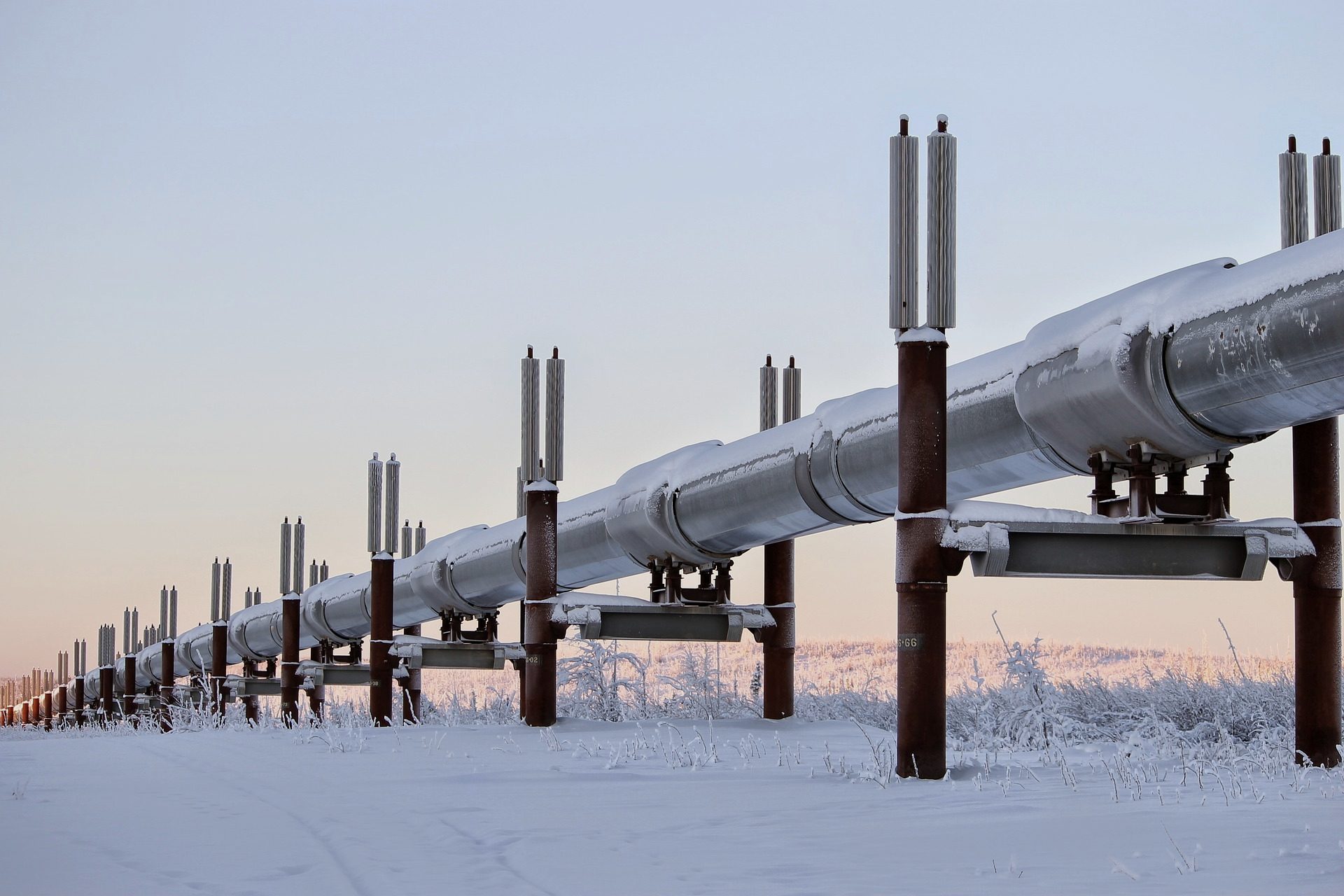
Live on pipeline corridors that patrols reach once a year.
Live awareness when the link is jammed.
Defense and homeland security have the same coverage gap, with more at stake. The mesh and on-node inference keep running where cloud systems stop.
Base + perimeter awareness
Detects intrusion, drones and unusual movement around a base, with or without GPS.
Communications-contested ops
When uplinks are jammed, nodes keep working locally and resync when the link comes back.
Border + infrastructure protection
Low-power, solar-capable nodes for long-range sensing in remote terrain.
Mission rehearsal + training
AR / VR overlays of real terrain and live asset data, for rehearsal before deployment.
Catch the ignition while one engine can stop it.
A wildfire caught in the first 15 minutes can be held by a single engine. Two hours later it may need a hundred engines and air support.
Nodes on utility right-of-way, park boundaries and the wildland-urban interface watch for smoke, heat and dry fuel.
Detect
Visible, thermal, smoke-chemistry and acoustic sensors, cross-checked on the node.
Verify
Live imagery and AR overlays reach dispatch and responders before the trucks roll.
Dispatch
Alerts land in your CAD and GIS, on the screens dispatchers already watch.
Raw signal in. A clear call out.
Faster response, fewer false alarms, and operators who trust the alert in front of them.